 French
 English
 Spanish
 German
 Russian
FIND YOUR WAY
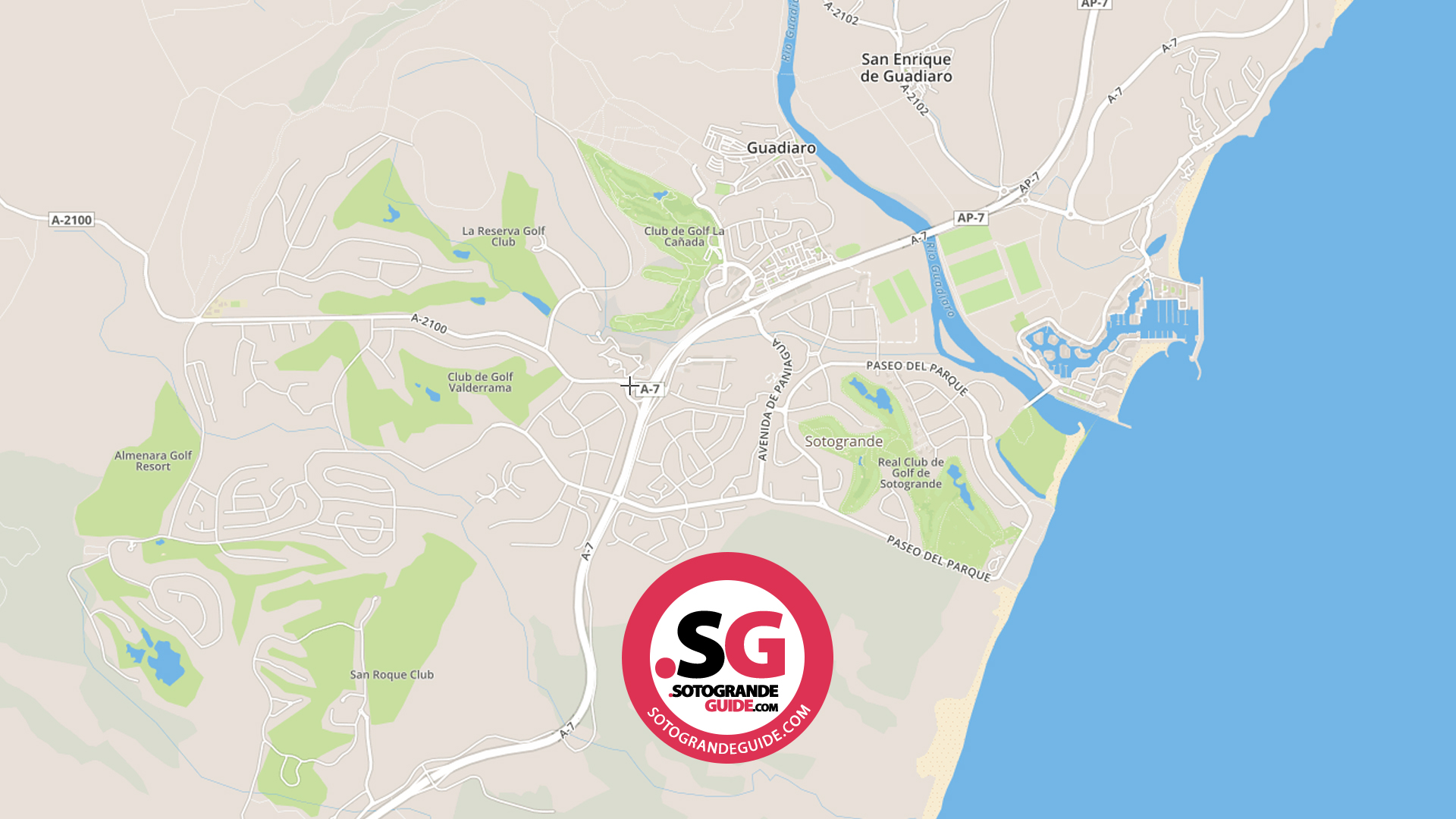
A practical map of Sotogrande and its surrounding communities, with useful starting points for your day.
Use the interactive map to explore, then choose the actual venue or address for directions. Sotogrande is a collection of neighbourhoods and destinations, so the nearest-looking point is not always the right entrance.
Explore the interactive map
Open Sotogrande in Google Maps
The map is supplied by Google. If it does not load, use the button above. Directions and journey estimates are provided by the map service, not checked in real time by this guide.
Choose an area
Sotogrande Marina & Port
Waterside restaurants, berths and apartment areas. Use the exact business name or pontoon entrance when meeting someone: a generic marina pin can leave you on the wrong side of the water.
Sotogrande Costa
The established coastal side of Sotogrande. Useful starting points include Paniagua, the beach approaches and the local club entrances. Check the street and house number for a villa visit.
Sotogrande Alto & La Reserva
The inland areas are spread out. A golf-club entrance, hotel reception and residential gate may have different access roads, even when the destination looks close on the map.
Pueblo Nuevo & Guadiaro
Useful for shops, services and everyday errands. Search for the actual shop or street rather than simply entering Sotogrande, especially for appointments in smaller commercial units.
Torreguadiaro & the coast
A coastal village beside the port area, with places to eat and access to the beach. Check your restaurant or beach access point before choosing where to park.
San Enrique & the polo areas
A useful orientation point for equestrian visits. Different grounds and club entrances are not interchangeable; use the organiser’s meeting point for a match or lesson.
Club San Roque
An inland residential and golf area with its own commercial centre. For Monday Friday Bistro & Minimarket or another tenant, use the commercial centre as your destination.
La Alcaidesa
A separate nearby coastal community. Check whether you are heading to the beach, a residential complex or the golf facilities: the final approach can differ substantially.
Make the last part of the journey easier
Ask your host for a dropped pin, building name and entrance instructions. For gated communities, arrange visitor access in advance. For the port, identify the plaza, berth or reception rather than relying on the broad port label.
Check parking signs and restrictions on arrival. A map pin does not establish public access, free parking or a pedestrian route. Avoid following a shortcut through a private estate or golf course unless access has been confirmed.
Plan more than the drive
Arriving without a car
Match your accommodation to the places you actually plan to visit. Confirm the walking route from the bus stop, not just the straight-line distance.
Choosing where to stay
Compare the marina, Costa, Alto and nearby communities against your plans for schools, golf, meals and evenings out.
Vos questions répondues
Where is Sotogrande?
Sotogrande is in the municipality of San Roque, in Cádiz province, southern Spain. It is close to the Málaga provincial boundary and part of the wider coastal area often associated with the Costa del Sol.
Is Sotogrande one town centre?
It is more useful to think in terms of neighbourhoods and nearby villages. The port, Paniagua, Pueblo Nuevo and other commercial areas serve different purposes; there is no single pin that works for every visit.
Are the port and marina the same place?
They are closely connected waterside areas, but names alone are not precise enough for a meeting. Ask for the restaurant, plaza, berth or building.
Can I walk from the marina to Sotogrande Alto?
Do not plan that journey from the map’s straight-line distance. Check the actual pedestrian route, crossings, terrain and lighting. For many visits a car or taxi will be more practical.
Is San Roque Club inside the marina area?
No. It is an inland destination with its own entrance and commercial centre. Use the full destination name when arranging a taxi or delivery.
How do I find Monday Friday Bistro & Minimarket?
Use Centro Comercial San Roque Club as your map search, then check the Monday Friday entry for context. It is not in Sotogrande Marina.
Can I get directions from my current location?
Open the map link and choose Directions in Google Maps. Your device controls location permission. You can also enter a starting address manually.
Does this map show traffic or road closures?
The map provider may offer traffic information, but this page does not independently verify it. Check the chosen route immediately before travelling.
Are all roads and club entrances open to visitors?
No assumption of access should be made from a map. Follow signs and confirm visitor arrangements with the venue or host.
Where should I meet a taxi?
Choose a named, accessible pickup point and share its pin. Mention any gate, barrier, luggage or child-seat requirement when booking.
Can I use the map offline?
Check your map app’s offline-area download feature before travelling. Live traffic, fresh closures and other online details may not be available offline.
Where can I find local services?
Utilisez le directory for services and the Useful Information guide for practical contacts.
Map and guide links reviewed on 13 October 2026. Geographic background: Sotogrande’s official destination information; maps and navigation supplied by Google.